Protected views

Or where I try and work out where a tall building is least likely to be sited.


Read more »

Network Wapping September Meeting

Panorama from the roof of fortress Wapping


Dear reader(s?), how could I leave you with such a cliff hanger?

How did the Network Wapping (NW) meeting go?

Did they take over the world as we know it, upturning Magna Carta, the Bill of Rights and Habeas Corpus?

The simple answer- it went quite well in my opinion with no evidence so far of a local illuminati being established.


Fast facts

Representation: 2 out of 5. A good mix of locals but the Asian community very under represented and relatively few men. Overall a good mix of ages. Some native Wapping people, though I don't know what the actual split is within the area to make a judgement.

Quality of discussion: 4 out of 5. A good range of views, led well by John, the meeting ended before the conversation, as the premises had to be vacated.

Progress: 3 out of 5. Views were captured on flip charts to be written up. John and another lady (I think I know who she is but I shan't name to save embarrassment should I get it wrong) were meeting with St George plc to introduce the group on Friday (yesterday) and hopefully share some high level ideas. What hasn't been made clear yet to attendees or the general public is what NW's purpose is. A discussion group is very different to a full neighbourhood planning forum (which I will discuss in a later post) and I think some fundamentals need to be set out, and I've emailed John in this respect.


The detail

I arrived early and with trepidation. The last community meeting I attended was with TfL discussing the Olympic Route Network and which I left early after tiring of the heated discussion/shouting. Wapping is keen to ask a question, and especially until they get the answer they want.

The meeting was reasonably well attended, maybe 20 people at a time with a little rotation through the night. Councillor Denise Jones attended the start (her ward of course extends to the 'bad north' and indeed I believe no longer captures her own home after the boundary crossed the road).

Coming from an accounting background I normally see a lot of very formal presentations, so John's was quite refreshing, based around photos, maps and designs representing concepts of the built environment in Wapping and globally.

Bridge linking the print works to the listed rum warehouse
Most of the meeting was spent discussing the development of the News International site and what we saw as priorities. I didn't express a view during the meeting. My philosophy in meetings is that I know what my views are and wait to get a feel for the meeting and only speak when I feel I can add value. Back during the discussions on the Town Council I was very vocal and I have a horrible feeling that (specifically at the meeting at St George's town hall) I suggested a community group should be established instead of an additional tier of government.

What struck me was the diversity of views and the balance between increasing local amenities without changing the character of the area. What was clear was that people genuinely had great affection for Wapping, but as an example of the disparate views expressed when the possibility of space being left for a high school it felt like two women exclaimed 'yes' and 'no' almost at the same time.

Gate between News International and Tobacco Dock
Similarly when the possibility of Tobacco Dock being used permanently as an events/exhibition centre, the tattoo convention was mentioned in passing. I've always enjoyed seeing a sea of body art flowing down the canal, or queuing up on Wapping Lane at 9.30am on a Sunday morning munching on Mcmuffins as I've walked to church. What I've never really noticed is the rubbish, which made one lady wish it didn't take place in Wapping. Talking it through, what it really needs is for extra stewarding and street cleaning. Perhaps making small changes in organisation could allow residents and visitors enjoy Wapping together. Ultimately, there is going to be a *massive* new development in Wapping. What NW has allowed though is for a lot of people to come together and be part of the discussion. If we want to influence this development we need to speak up, and whether it's as individuals or as a group, you can only blame yourself if your view wasn't expressed.

A quick summary of people's desires for the site is (I didn't take notes so I could be way off track):

  • Open access, not another gated community
  • Community facilities: GP surgery, community centre, schools (maybe a small vertical high school)
  • Routes through the site, both east-west (Vaughan Way to Pennington St and the canal) and north-south ( The Highway to the canal)
  • Not too dominant on the skyline
  • Some moderate support for truly sustainable building
  • Minimise air pollution during the demolition (cf Leman St)


How Dense (2)

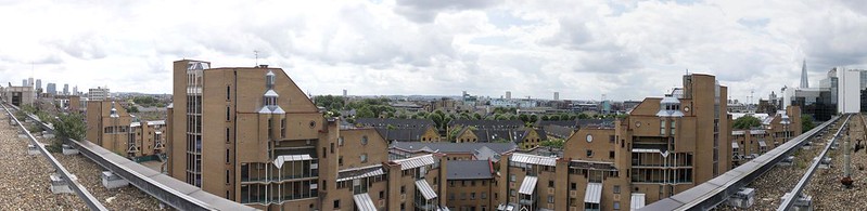
I've included the second part of my analysis of population density below, but thought it useful to pull together some reflections on the implications for Wapping. My train of thought is thus:
  1. LBTH's Core Strategy earmarked Wapping for the provision of 1,470 new units of housing between 2010 and 2020 [LBTH Core Strategy, Appendix, 'Housing investment and delivery programme, p.146]
  2. 121 Wapping Lane provides c. 400 (I've seen numbers between 382 and 450 quoted), and there have been a handful, such as a gap filling exercise on Penang Street, but nothing else significant.
  3. 21 Wapping Lane is on a site of 0.8104 ha [21 Wapping Lane planning application]
  4. The NI site is 7.5 times larger than 21 Wapping Lane, which at the same density would theoretically yield approximately 2900 units.
So, post 21 Wapping Lane, Wapping needs to find space for just over 1,000 units of housing. The only development sites that I'm aware of are:
  • 140 Wapping High Street
  • Warehouse opposite 140 Wapping High Street
  • Two buildings associated with St Patrick's church
  • Warehouse/commercial building on Cinnamon Street
  • Land opposite the Captain Kidd
  • Land by John Orwell
  • Two patches of Land on Pennington Street /The Highway (one of which was mooted as a hotel)
Realistically, without demolishing the buildings or building multiple storey buildings, the NI site is realistically going to be the source of these units of housing.

Assuming an average of two people per unit of housing, we're looking a perhaps an extra 3,000 people in Wapping, or an increase of roughly 25 per cent of Wapping's population in 2009, of which perhaps 2,000 will need to be on the NI site.

However, even if we applied the current population density of LBTH (109 people per hectare) to the NI site, that only gives us an increase of 670 residents. So, to bring us to 2,000 new residents on the NI site, it will be necessary to build a cluster of housing nearly three times as dense as the rest of LBTH.


Number of residents based on maintaining existing densities to area of site
   LBTH   NI Cluster  LBTH less Wapping & NI cluster  Wapping+NI   Wapping 
Including NI site in existing density calc
                 668
             633
                 686
458
428
Excluding NI site in existing density calc
670
708
689
475
444

Does any of this actually matter? Well, yes:

  • LBTH has decided that Wapping needs 1,400 new housing units
  • There is a lack of development space in Wapping, therefore 1,000 of the units realistically need to be built on the NI site.
  • LBTH approved 21 Wapping Lane.
  • If the density of housing on 21 Wapping lane was replicated over the NI site it would possibly yield 2,900 units of housing (bear in mind that 21 Wapping Lane will have some leisure space).
Now, would LBTH be able to resist the possibility of 2,900 new housing units, relieving its development ambitions?

Realistically, I don't think that the NI site would be as densely built as 21 Wapping Lane- ultimately a development of that size will need open space, which 21 Wapping Lane can avoid providing to the same extent (it is sat on a canal, by Wapping Woods). If there is going to be any significant commercial/office or leisure space, population density will be decreased. Reading some correspondence between St George's planning consultants and LBTH, I get the impression they'll want a reasonable amount of carparking (they object to LBTH's low number of car parking spaces allowed per unit of housing), whereas 21 Wapping Lane is a largely car free development, which may reduce density further.

I'll keep trawling the web and see if anything else is being hinted at.


Comparative population densities

First off, a re-cap of my previous post on population density:

TABLE 1: Areas, population and density
 LBTHNI ClusterLBTH less Wapping & NI clusterWapping & NIWapping

Area             2,157                58                      1,980                     176                168

Population         234,765          5,981                 221,607               13,158          11,716

Density                 109              103                         112                        75                   70

Excluding NI site

Area             2,151                52                      1,974                     170                162

Density                 109              115                         112                        77                   72

The second row of density figures calculate population density by deducting the area of the NI site (6 hectares) from the respective area, to get an idea of the population density when on excludes a large unpopulated area, however, the actual impact isn't that significant.

The next table simple presents the data in the first table in a slightly different way by comparing the population densities of the different areas. For instance, LBTH has a population density of 39 more people per hectare than Wapping. What it does make obvious is that the cluster of LSOAs around the NI site has a relatively high population density compared to Wapping as a whole.

TABLE 2: Differences in densities
Difference in densities (includes NI site area) - people per hectare

  LBTH  NI Cluster LBTH less Wapping & NI cluster Wapping & NI  Wapping 

Wapping39 33 42 5 0

Wapping+NI34 28 37 0

LBTH less Wapping & NI cluster-3 -9 0


NI Cluster6 0


LBTH0


TABLE 3 is probably the most interesting, as it takes the difference in density from TABLE 2 and applies it to the area (number of hectares) of the relevant location per TABLE 1 to consider how many additional residents would need to be present to equalise population densities.

For example, Wapping's density is 39 people per hectare lower than LBTH as a whole (TABLE 2) which when multiplied by Wapping's area (168 hectares - TABLE 1) gives 6,580 extra people, which is quite a lot. Furthermore, if one were to exclude Wapping & the NI cluster from the calculation of LBTH's density (not counting either Wapping's area or population in the figures of LBTH), you can see that you would actually need to house an extra 7,091 residents (Wapping's low density means that it drags LBTH's density down).

TABLE 3: Additional population change necessary to equalise population densities


 Benchmarked area 
   LBTH  NI Cluster LBTH less Wapping & NI cluster Wapping+NI  Wapping 
Area receiving additional residentsWapping6,5805,6227,0918340
Wapping & NI6,0245,0206,5600
LBTH less Wapping & NI cluster-6,024-17,3100

NI Cluster3300


LBTH0

I've calculated the same below, but deducting the 6 hectares of the NI site, however, this doesn't make a massive difference.


TABLE 4: Differences in densities (excludes NI site area)
Difference in densities (excludes NI site area) - people per hectare

  LBTH  NI Cluster LBTH less Wapping & NI cluster Wapping & NI  Wapping 

Wapping36.82 43.02 39.90 5.02 0.00

Wapping & NI31.80 38.00 34.88 0.00

LBTH less Wapping & NI cluster-3.08 3.12 0.00


NI Cluster-6.20 0.00


LBTH0.00


TABLE 5: Additional population change necessary to equalise population densities (excludes NI Site area)


Benchmarked area 
   LBTH  NI Cluster LBTH less Wapping & NI cluster Wapping & NI  Wapping 
Area receiving additional residentsWapping5,9626,9666,4618120
Wapping & NI5,4096,4635,9330
LBTH less Wapping & NI cluster-6,0796,1580

NI Cluster-3210


LBTH0

How dense?

James Murdoch's office
Not actually a post about my intellect or lack thereof, but on the density of residents in the area (yes I've chosen to write a blog on more demographic guff).

The map below plots the population density of Wapping and surrounding areas, and takes in all parts of Wapping and a few neighbouring LSOAs (Lower Layer Super Output Area - how the Office for National Statistics breaks the country down).

Population density is measured by taking population and dividing by the area in question (in this case hectares, or 10,000 sq metres, equivalent to a square 100 metres by 100 metres).

My colour code goes from very light green (zero people per hectare) to dark red (320 people per hectare). For reference Greater London (32 boroughs) is around 50 people per hectare, Kensington and Chelsea is 140 and Westminster 118. However, depending on the mix between residential, commercial, industrial and open space will interact to affect population density, so you can have low population density but very little greenspace, which makes simple comparison difficult.

In my map you can see there's a big variation in density, with the area around Shadwell station packing in 304 people per hectare and the Glamis / Cable Street area achieving 288, compared to parts of Wapping with only 38.7 (albeit with a marina in the middle).

Now, a word of caution; the LSOAs are broadly drawn to capture 1,000 people (see below for details), so density of different LSOAs may vary drastically, whereas, if larger blocks of a standard area were used, density wouldn't fluctuate as much, so we need to avoid reaching tautological conclusions. However, the data does let us see were residential populations are built up. One flaw with my data is that it excludes any increase in population arising from 21 Wapping Lane. However, I think that in someways that it's appropriate not to include such a significant development, as if a series of such developments were built, as here we're looking at relative population density in a mature settled community. To include such a large development in the analysis might lead to perverse conclusions when we don't know yet what the overall drain on the community's amenities will be.

Density of parts of LBTH

Apologies for the tables - at some point I will be motivated to write them in HTML rather than copying and pasting from my workings in Excel.

What we can tell from my dataset (see below) is that density in LBTH as a whole is quite a bit higher than for Wapping. However, looking at the 4 LSOAs which overlap or are directly touching the News International site (I label them 'NI Cluster' and are LSOAs TH 026A-D) shows that the existing population density is not much lower than LBTH as a whole, but relatively higher than Wapping, because of the presence of the St George's estate. I've also calculated densities excluding the area of the NI site to see if that affects the population density for the rest of the area - the answer is not massively.

Now, a big caveat here - Wapping has a lot of water - whether or not it should be excluded is a diffcult question. Clearly, you can't build on it, so renders comparing urban population density difficult, but does lead to a feeling of openess.


LBTHNI ClusterLBTH less Wapping & NI clusterWapping& NI
Wapping
Area
2,157
58
1,980
176
168
Population
234,765
5,981
221,607
13,158
11,716
Density
109
103
112
75
70
Excluding NI site
Area
2,151
52
1,974
170
162
Density
109
115
112
77
72


Populating the NI site

So, realistically, how many residents should be housed on the NI site. Whats in Wapping stated it was 15.16 acres when St George plc acquired the site - which is 6.135 hectares. Assuming that the developers wish to have a mixed use development, rather than make it purely a housing estate with no additional facillities, we get the following figures:

Number of residents based on maintaining existing densities to area of site

LBTH
NI Cluster
LBTH less Wapping & NI cluster
Wapping+NI
Wapping
Including NI site in existing density calc
668
633
686
458
428
Excluding NI site in existing density calc
670
708
689
475
444
Now if this gives a baseline increase in population, the question arises of how many units of housing. Clearly the answer depends on how many people live in each one. My preference would be for a larger number of 3 bed properties, of which I have a feeling from my initial research that there are a lack of in the area, catering for famillies rather than transient young professionals. I'll need to have a look into if there's any info on profitability of different sized housing units to see what motivates developers.

I've also calculated the extra number of residents that the site would need to accommodate to bring the overall density of Wapping upto the rest of LBTH, but I need to format these tables first.

About output areas


MSOAs are made up of LSOAs and LSOAs are made up of OAs - you at the back, keep up and pay attention.

MSOAs, LSOAs and OAs are defined by the Office of National Statistics and broadly come together to match Boroughs and Wards, but not necessarily(!). As a handy hint, OAs contain a minimum of 100 people, LSOAs 1000 and MSOAs 5,000 with the average size of each about 50% higher than the minimum. See the ONS website for more details.


Data source

http://data.london.gov.uk/datafiles/demographics/lsoa-data-2012.xls


Popular Posts